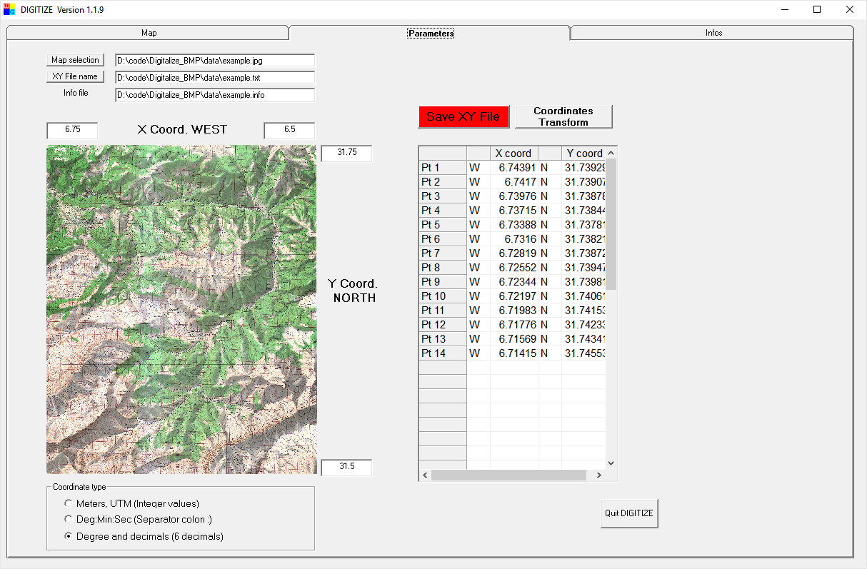
With Digitize_BMP allows you to display a map or picture (BMP or
JPG) and pick XY value along a road, any limit. Data format can be degree,
minutes, seconds, degree and decimal are kilometric
grid. Coordinates are saved in a text file.The
software is user friendly and can be used very intuitively. Digitize_BMP
run under all 64 bits Windows.
Conversion module
from usual system is available (Degree min sec, SWISS grid, UTM, LT3, LT93,
ED50 NTF, WGS84, Lambert...)
1. Select the
type of data (Degree, kilometric grid..)
2. Select a
map (BMP or JPG)
3. Select the
coordinate system enter map corner coordinates
4. Display
the map and start picking (Left button to remove a point)
5. Save the
data file
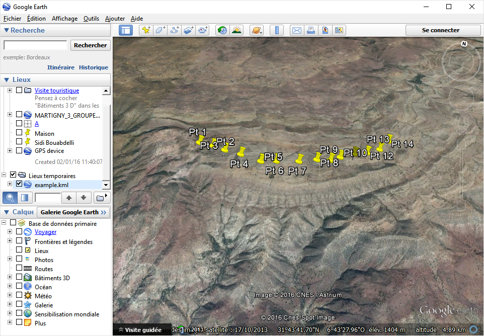
6. Optionally display the data on GOOGLE Earth
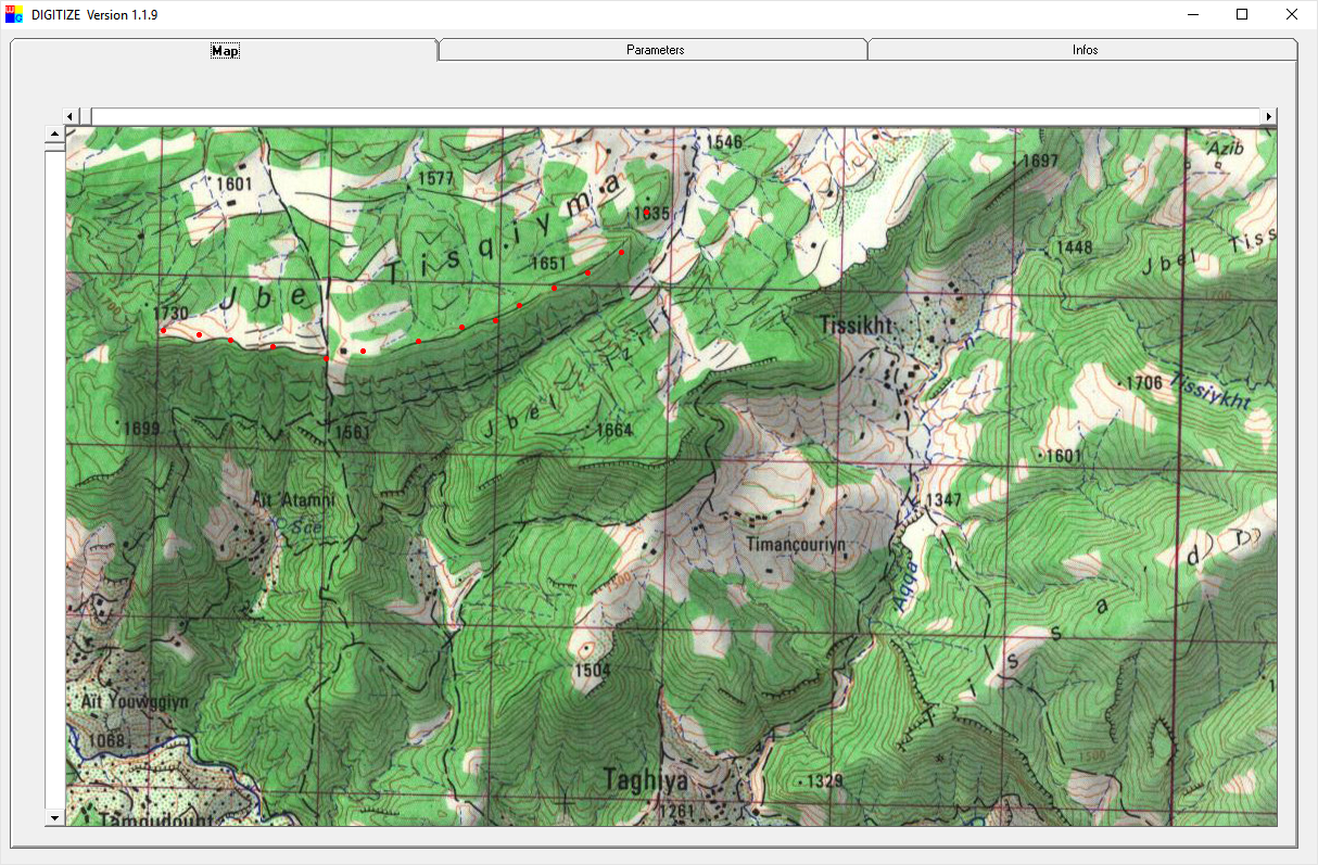
The picking window
|
|
|
|
|
|
|
|
|
|
|
|
|
|
|
Ask
for a demo version jacques@w-geosoft.com